Vercelli Airfield
Appearance
Vercelli Airfield Aeroporto di Vercelli | |||||||||||
|---|---|---|---|---|---|---|---|---|---|---|---|
| Summary | |||||||||||
| Airport type | Civil | ||||||||||
| Operator | Aero Club Vercelli "Marilla Rigazio" | ||||||||||
| Serves | Vercelli | ||||||||||
| Location | Vercelli | ||||||||||
| Elevation AMSL | 417 ft / 127 m | ||||||||||
| Coordinates | 45°18′40″N 8°25′3″E / 45.31111°N 8.41750°E | ||||||||||
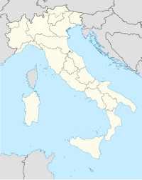
| Map | |||||||||||
 | |||||||||||
| Runways | |||||||||||
| |||||||||||
Vercelli Airfield is an airfield located south of Vercelli, Italy. The structure is equipped with a grass track with 09/27 orientation. The airport is managed by the Aero Club Vercelli "Marilla Rigazio" and carries out activities according to the rules of visual flight.
Vercelli Airfield was inaugurated in 1928.[1]
References
[edit]- ^ "Aero Club Vercelli | Dal 1928 Vercelli vola". www.aeroclubvercelli.it. Archived from the original on 5 February 2016. Retrieved 4 February 2016.

